How to Read Tide Charts for Better Fishing in New Jersey
There's nothing quite as frustrating as waking up before dawn, meticulously packing your gear, driving to your favorite New Jersey fishing spot, and then… nothing. Crickets. Or rather, no bites. You've got the right bait, the perfect lure, and you're at a proven location, but the fish just aren't cooperating. More often than not, the culprit isn't your skill or your tackle; it's the tide. Fishing without understanding the tides in New Jersey's diverse waterways is like trying to navigate a dense fog – you might get lucky, but more likely, you'll be lost. This comprehensive guide will demystify tide charts, explain how they impact fish behavior, and teach you how to use this crucial information to dramatically improve your catch rate in the Garden State.
The Frustration of Fishing the Wrong Tide
We’ve all been there. You scout a gorgeous stretch of the Jersey Shore, maybe a pristine beach at Island Beach State Park, or a promising jetty at Manasquan Inlet. You arrive, full of anticipation, only to find the water flat, devoid of any signs of life. No baitfish jumping, no gulls diving, just… still water. It feels like you’ve missed the party entirely, or worse, arrived when it was already packing up. This feeling of hitting the water at the "wrong time" is a common frustration, and it often stems from overlooking the most fundamental factor in saltwater and even some freshwater tidal fishing: the movement of the water itself.
Why Anglers Miss the Bite
Many anglers, especially those newer to the saltwater scene or accustomed to still freshwater lakes, don't fully grasp just how much fish activity is dictated by tidal currents. They might show up at what they think is the best time of day – early morning, late evening – without considering what the ocean or bay is actually doing. The problem is, fish aren't on a human schedule; they're on a lunar one. They react to changes in current, water depth, and baitfish movement, all of which are directly influenced by the tides. If you arrive during a stagnant slack tide, for instance, baitfish might be hunkered down, and predatory fish like striped bass or fluke won't be actively feeding, making your efforts largely futile. It’s not your fault if you didn’t know; it’s just one of those crucial pieces of knowledge that separates a consistently successful angler from someone who only catches fish on rare, lucky occasions.
The Hidden Power of Water Movement
Think of the tide as the breath of the ocean, constantly inhaling and exhaling. This constant ebb and flow isn't just about water level; it's about the powerful currents it creates. These currents are the lifeblood of an estuary or coastal environment. They flush out baitfish from their hiding spots in marsh grass, carry nutrient-rich water, and concentrate prey species in predictable locations. For a predator, a strong current is like a conveyor belt of food. They'll position themselves strategically to ambush whatever passes by.
On the other hand, a weak or non-existent current, known as "slack tide," means less food movement, less oxygenation in some areas, and often, less active feeding by game fish. Understanding this fundamental principle—that moving water equals moving food, which equals active fish—is the first step toward reading tide charts like a seasoned pro. It's about aligning your fishing efforts with the natural rhythms of the ecosystem, rather than fighting against them. Once you understand this, you'll stop asking "Are the fish biting?" and start asking "What's the tide doing?"
Understanding the Basics of New Jersey Tides
New Jersey's coastline is incredibly diverse, from the wide-open Atlantic beaches to the intricate back bays, winding tidal rivers, and the expansive Delaware Bay. While the moon's gravitational pull is the primary driver of tides everywhere, the local geography profoundly influences how those tides manifest. Knowing the basic terminology and principles is essential before you can truly put a tide chart to work for you.
High Tide vs. Low Tide Explained
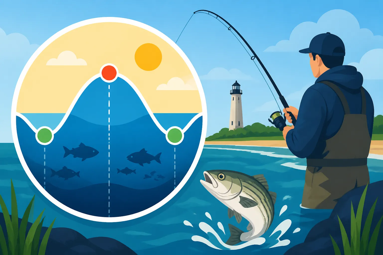
At its core, a tide chart tracks the cycle of high tide and low tide. In New Jersey, like most places on the East Coast of the United States, we experience a semi-diurnal tidal pattern, meaning there are typically two high tides and two low tides each day. This cycle is roughly 12 hours and 25 minutes long, which is why the tides occur about 50 minutes later each day.
- High Tide: This is when the water reaches its maximum height. At high tide, particularly in the back bays and tidal rivers, more water pushes into shallower areas, flooding marsh grass, oyster beds, and other structures. This can make new feeding grounds accessible for fish, but it also disperses them over a larger area. For surf anglers, a high tide often brings deeper water closer to shore, making it easier to cast into prime feeding zones without needing a monstrous cast.
- Low Tide: Conversely, low tide is when the water reaches its minimum height. During low tide, many shallow areas, sandbars, and mudflats become exposed or extremely shallow. This concentrates baitfish and other forage into deeper channels and cuts, making them easier targets for predatory fish. For jetty anglers, low tide can reveal hidden structure and deeper pockets. For kayak anglers exploring the back bays, understanding low tide is critical for navigation, ensuring you don't get stranded on a mud flat!
The key is not just when high or low tide occurs, but how the water moves between these two points.
The Role of Current in Tidal Waters
While high and low tide mark the extreme points of water depth, it's the current —the horizontal movement of water—that really gets the fish active. As the water level changes, massive amounts of water are pushed in and out of bays, rivers, and inlets.
- Incoming Tide (Flood Tide): This is the period when the water level is rising, moving from low tide to high tide. As the water pushes in, it often brings cooler, cleaner, more oxygenated water from the ocean into the bays and estuaries. This is a fantastic time for many species, as the current dislodges baitfish, crabs, and other forage from structure, pushing them along like a buffet. Striped bass and fluke, for example, will often ambush prey along current seams, eddies, and channel edges during an incoming tide.
- Outgoing Tide (Ebb Tide): This is when the water level is falling, moving from high tide to low tide. As the water recedes, it pulls everything out of the back bays, marshes, and creeks. This can be equally productive, as baitfish are flushed out of their shallow hiding spots and pushed into deeper channels, making them vulnerable. Many anglers find the last few hours of an outgoing tide, especially when it's emptying out of a major estuary, to be incredibly productive for species like bluefish and weakfish.
The speed and strength of these currents vary greatly depending on the location and the specific tidal phase. Knowing the local current dynamics is often more important than just knowing the high or low tide times.
Spring Tides and Neap Tides
Beyond the daily cycle, tides also follow a monthly pattern influenced by the alignment of the sun and moon. These create what are known as "spring tides" and "neap tides," and they have a significant impact on fishing conditions.
- Spring Tides: These are the strongest tides, characterized by exceptionally high high tides and very low low tides, resulting in a large tidal range and strong currents. They occur twice a lunar month: around the new moon and the full moon. During spring tides, the gravitational forces of the sun and moon combine, creating a powerful pull on the Earth's oceans. For anglers, this means vigorous currents, which can be fantastic for targeting aggressive predators that feed in strong rips, like big striped bass in an inlet. However, strong currents can also make fishing challenging, requiring heavier weights and precise lure presentation.
- Neap Tides: These are the weakest tides, with less dramatic differences between high and low tide, and consequently, weaker currents. They occur during the quarter moon phases (first quarter and last quarter). During neap tides, the gravitational pulls of the sun and moon are at right angles to each other, partially canceling each other out. This results in a smaller tidal range. Neap tides can be excellent for targeting species that prefer less aggressive currents, or for fishing in areas where strong currents make it impossible to hold bottom. They can also be a good time to explore shallower backwater areas that are typically too turbulent during spring tides.
Understanding whether it's a spring or neap tide cycle helps you anticipate the strength of the currents and plan your gear and tactics accordingly. For example, if you're fishing a deep channel with a strong current during a spring tide, you might need a much heavier bucktail jig than you would during a neap tide.
Where to Find Reliable New Jersey Tide Charts
You can't effectively fish the tides if you don't know when they're happening! Thankfully, in our digital age, reliable tide information is readily available. Gone are the days of guessing or relying solely on a crumpled newspaper clipping. There are several excellent resources, both online and local, that can provide you with the accurate tide predictions you need for New Jersey's vast waterways.
Online Resources and Apps
The easiest and most common way to access tide charts today is through the internet or dedicated mobile applications. These resources often provide real-time or very accurate predictions for numerous locations along the New Jersey coast and its tidal tributaries.
- NOAA Tides & Currents: The National Oceanic and Atmospheric Administration (NOAA) is the gold standard for tide predictions. Their website provides official, highly accurate tide data for thousands of stations across the U.S., including a comprehensive selection for New Jersey. You can search by specific locations like Barnegat Light, Sandy Hook, or Cape May. This is a fantastic resource for planning trips well in advance. While it might look a little technical, once you understand the basic terms, it's incredibly powerful.
- Fishing-Specific Apps: Many mobile apps cater specifically to anglers, integrating tide data with other useful information like moon phases, weather, and even bite times. Popular choices include Fishbrain, Navionics (which also offers marine charts), and numerous dedicated tide apps like "Tides Near Me" or "Pro Angler." These apps often have user-friendly interfaces, graphical representations of the tidal flow, and can pinpoint your exact location for the nearest tide station. They're invaluable for checking conditions on the go. Many of these apps can be downloaded for free or purchased for a small fee via platforms like Amazon.
- Weather Websites and Apps: Major weather forecasting services like AccuWeather, Weather.com, and local news station apps often include tide charts for coastal areas as part of their marine forecasts. While perhaps not as detailed as a dedicated tide app, they can provide a quick overview of high and low tides for your chosen area.
When using online resources, always double-check that you're looking at data for the exact location you plan to fish. Tides can vary significantly even a few miles up a bay or river from the primary ocean inlet.
Local Bait Shops and Publications
While digital resources are incredibly convenient, don't underestimate the value of traditional, local sources, especially when you're in an unfamiliar area or want hyper-local insights.
- Bait and Tackle Shops: This is your absolute best local resource. Any reputable bait and tackle shop along the Jersey Shore, or near a major tidal river like the Delaware, will have tide charts readily available, often printed out and posted prominently. More importantly, the folks working there are usually seasoned local anglers who can tell you how the tides are fishing right now at specific spots. They can offer advice like, "The outgoing tide has been hot for fluke at the Point Pleasant Canal," or "Don't bother with the incoming tide at this jetty, the current is too strong." This kind of real-world, current information is gold.
- Local Fishing Publications and Newspapers: Many areas along the New Jersey coast have local fishing newspapers or magazines that are published weekly or monthly. These often include comprehensive tide tables for various local spots. While they might not be as instantaneous as an app, they are great for planning out a week or a month of fishing trips and getting a broader overview of seasonal patterns. These publications are typically free and available at bait shops, marinas, and even some convenience stores.
- Marine Stores and Marinas: These establishments, particularly those that cater to boaters, will also often have tide charts available, sometimes even specific ones for their immediate area or the local bay system. They might also sell waterproof tide books that are handy to keep on a boat or in your tackle bag. You can often find a good selection of these on Amazon if you prefer to purchase one to keep handy.
Combining digital tools with local intel is the most effective approach. Use your phone or computer to get the raw data, then visit a local bait shop to get the nuanced, real-time interpretation from someone who fishes those waters daily. This blend ensures you're both informed and strategically advised.
Decoding the Tide Chart: What All Those Numbers Mean
Once you have your tide chart in hand, whether it's on your phone or a paper printout, it can look like a jumble of numbers and abbreviations. But fear not! Each piece of information is there to help you, and once you understand what you're looking at, it becomes a powerful tool. Let's break down the essential components you'll encounter.
Understanding Time and Height
The most fundamental information on any tide chart relates to the time and height of the tides.
- Time: This is usually listed in either local time or UTC (Coordinated Universal Time), so always confirm which one is being used, especially if you're using an international app. For New Jersey, it will almost always be Eastern Time. You'll see specific times listed for "High Tide" (often abbreviated as "HW" or "H") and "Low Tide" (often "LW" or "L"). These are the precise moments when the water reaches its peak or trough.
- Example: If a chart shows "HW 08:30 AM" and "LW 02:45 PM," it means high tide is at 8:30 AM and low tide is at 2:45 PM. The periods between these times represent the incoming and outgoing tides.
- Height: Alongside the time, you'll see a corresponding height, usually in feet or meters (sometimes with a plus or minus sign, referring to a datum line, often Mean Lower Low Water or MLLW). This number tells you how high the water will be at that particular high or low tide.
- Example: "HW 08:30 AM 4.5 ft" means high tide is at 8:30 AM, and the water level will be 4.5 feet above the average low water mark. "LW 02:45 PM -0.2 ft" indicates a very low tide, almost exposing some areas.
The height is incredibly important. A 6-foot high tide will have a much more significant impact on water depth and current strength than a 2-foot high tide. Pay attention to how high or low the tide is predicted to be, as it will tell you a lot about how accessible certain areas will be and how strong the currents might become.
Tidal Range and Its Significance
The tidal range is simply the difference in height between a successive high tide and low tide. This is a critical piece of information because it directly correlates with the strength of the tidal currents.
- Calculating Tidal Range: If high tide is 4.5 ft and the subsequent low tide is -0.2 ft, the tidal range is 4.5 – (-0.2) = 4.7 feet. A larger tidal range means more water is moving in or out over a given period, resulting in stronger currents.
- Significance for Fishing:
- Large Tidal Range (Strong Currents): These are typically associated with spring tides. Strong currents can be excellent for highly migratory and predatory fish like striped bass, bluefish, and certain types of tuna that feed in rips and eddies. They can also be challenging for bottom fishing, requiring heavier weights to hold your bait. Areas like the Manasquan Inlet or Raritan Bay often experience significant current fluctuations.
- Small Tidal Range (Weak Currents): These are characteristic of neap tides. Weaker currents can be more favorable for fishing shallower flats, sheltered bays, or for targeting species that prefer less turbulent water, such as winter flounder or some panfish in tidal creeks. It's also easier to fish with lighter tackle and finesse presentations.
By observing the tidal range for your chosen location, you can anticipate the current conditions and adjust your fishing tactics, bait choices, and tackle accordingly. This is where the magic of reading a tide chart truly begins to unlock success. You're not just looking at numbers; you're visualizing the actual movement of the water.
Incorporating Sun and Moon Phases
While not always explicitly listed on every basic tide chart, savvy anglers will also pay attention to the moon phase and, to a lesser extent, the sun's position. Many advanced tide apps and fishing almanacs, including those available for purchase on Amazon, integrate this information.
- Moon Phases: As discussed earlier, the new moon and full moon phases bring the strongest (spring) tides, while the quarter moons bring the weakest (neap) tides. Knowing the current moon phase allows you to predict whether the currents will be ripping or mild, even before you look at the exact heights on the chart.
- New Moon & Full Moon (Spring Tides): Expect powerful currents, fast-moving water, and often the most aggressive feeding windows for certain species. These can also be the best times for a significant "bait push" out of the back bays.
- Quarter Moons (Neap Tides): Anticipate gentler currents. These can be ideal for fishing calmer areas or when you want to use lighter tackle and more delicate presentations.
- Sun's Position (Day vs. Night): While the sun primarily influences the timing of tides (along with the moon), the actual time of day can also affect fish behavior, especially for sight feeders or nocturnal predators. Many species, particularly striped bass, are more active feeders during low light conditions (dawn, dusk, or night) regardless of the tide. Combining a productive tide phase with a low-light period can create exceptionally hot bite windows. For instance, a strong incoming tide at dawn during a new moon could be absolutely phenomenal for stripers.
Thinking about the celestial influences adds another layer of sophistication to your tidal fishing strategy. It's about understanding the big picture of how the entire environment is working together to influence the fish.
How Different Tides Affect Fishing Behavior
Now that you can read a tide chart, the real skill comes in translating those numbers into actionable fishing strategies. Different tidal phases create unique opportunities and challenges, and understanding how fish react to them is paramount.
Fishing a Rising Tide
The incoming, or flood, tide is often a favorite among many New Jersey anglers, and for good reason. As the ocean pushes water into the bays, estuaries, and tidal rivers, it invigorates the entire ecosystem.
- What's Happening: As the water level rises, it floods into marsh grass, over oyster beds, and into shallow creeks that were previously exposed or too shallow. This often dislodges crabs, shrimp, and small baitfish like killifish and spearing, making them accessible prey. The incoming current also brings in cooler, cleaner, and more oxygenated water from the ocean, which can stimulate fish activity, especially during hot summer months.
- Fish Behavior: Predatory fish such as striped bass, bluefish, and fluke often move into these newly accessible areas, patrolling the edges of marsh banks, shallow flats, and channel entrances to ambush disoriented bait. They'll face into the current, waiting for food to be delivered to them. For fluke, the rising tide often means they can move up onto shallower flats and ambush bait moving with the current. This phase is often the best time to target species moving into an area.
- Tactics:
- Back Bays & Estuaries: Focus on fishing along the edges of marsh banks, around oyster beds, and at the mouths of smaller creeks as the water pushes in. Use soft plastics, small bucktails, or live bait like killifish or spearing. Many anglers prefer to drift fish for fluke in the bays during the middle of the incoming tide, allowing the current to present their bait naturally.
- Inlets & Rivers: Fish the eddies and current seams, where bait might be temporarily trapped or slowed down. Use bucktails, swim shads, or live bunker.
- Surf Fishing: As the tide rises, it often pushes bait closer to shore and brings deeper water within casting range. Focus on fishing rips and cuts formed by sandbars. Clams, bunker chunks, or artificial lures can be highly effective. The last two hours of the incoming tide and the first hour of high tide are often peak times for How to Fish a Rising Tide.
Fishing a Falling Tide
The outgoing, or ebb, tide is equally productive but presents a different set of opportunities. This is when the water drains out of the backwaters, forcing baitfish and other forage into predictable escape routes.
- What's Happening: As the water level recedes, all the bait that moved into the shallow marshes and creeks during high tide is now flushed out, often concentrated into deeper channels, cuts, and the main current flow of bays and rivers. This creates a funnel effect, making these areas prime ambush points for predators.
- Fish Behavior: Striped bass, bluefish, weakfish, and fluke will often position themselves at strategic choke points – bridge pilings, channel junctions, the mouths of creeks, or the edges of flats – to pick off the fleeing bait. They know exactly where the food will be concentrated. The stronger the current, the more effective this funneling action becomes. This is a prime time for species moving out of an area or concentrated in channels.
- Tactics:
- Back Bays & Estuaries: Target the deeper channels, creek mouths, and bridge pilings where bait is forced to move. Use larger baits or lures that mimic distressed baitfish. Fishing the last two to three hours of an outgoing tide can be particularly productive, especially as the water gets lower and bait is most concentrated.
- Inlets & Rivers: The outgoing tide can create powerful rips and eddies in inlets, perfect for targeting larger predatory fish. Heavily weighted jigs, large swimbaits, or live eels can be very effective here. Many anglers find the falling tide to be the prime time for Best Tide to Fish a New Jersey Inlet.
- Surf Fishing: As the tide falls, look for areas where water drains off the beach, forming "run-outs" or deeper troughs that can hold fish. These can be prime spots for striped bass. Bunker chunks, clam, or metal lures can be effective. For more detailed insights, check out How to Fish a Falling Tide.
Slack Tide: Friend or Foe?
Slack tide is the relatively brief period (usually 30-60 minutes) when the water is neither rising nor falling significantly – the moment between an incoming and outgoing tide, or vice versa. The current essentially pauses.
- What's Happening: During slack tide, the strong currents that move baitfish and create ambush points dissipate. The water becomes still, and baitfish can disperse more freely, making them harder for predators to target.
- Fish Behavior: For many aggressive, current-oriented predators like striped bass and bluefish, slack tide can be a "slow down" period. They might move off their ambush points and become less active. However, this isn't always the case for all species or all locations. Some fish actually prefer calmer water.
- Tactics:
- Foe for Many: For targeting species like striped bass or bluefish in strong current areas, slack tide is often considered the least productive time. Anglers might use this period to move to a new spot, re-rig, or take a break.
- Friend for Some: Certain species, or certain fishing techniques, can actually benefit from slack tide. Bottom feeders like tautog (blackfish) often become more active as the current eases, making it easier for them to pick at crabs and other crustaceans from structure without fighting a strong pull. In very deep water, where currents are always strong, slack tide might be the only time you can effectively present a bait on the bottom without needing excessive weight. For finesse fishing with lighter tackle, a slack tide can also be beneficial as your lure won't be swept away as quickly. This is often a good time to target the edges of structure where fish might be resting.
Understanding these behaviors allows you to maximize your time on the water, ensuring you're fishing strategically rather than just hoping for a bite.
Tailoring Your Strategy to Specific New Jersey Fishing Spots
New Jersey's coastline is a tapestry of diverse environments, and a "one-size-fits-all" tidal fishing strategy simply won't cut it. The way tides behave, and how fish react, varies dramatically from a wide-open ocean beach to a narrow inlet or a sprawling back bay. To truly master tidal fishing, you need to understand how these different environments interact with the lunar pull.
Inlet Fishing and Strong Currents
New Jersey's numerous inlets—like Manasquan, Shark River, Barnegat, and Cape May—are some of the most popular and productive fishing grounds, precisely because of their strong, concentrated tidal currents.
- Tidal Dynamics: Inlets act like funnels, constricting vast amounts of water flowing in and out of the ocean and back bays. This creates incredibly strong, often turbulent, currents that can sweep baitfish and challenge anglers. The tidal range is typically significant here, leading to powerful rips. For more on this, consider reading Manasquan Inlet Fishing Guide.
- Fish Behavior: Large migratory fish, especially striped bass and bluefish, congregate in inlets to ambush bait that is either being flushed out of the bay (outgoing tide) or pushed into it from the ocean (incoming tide). They often hold in eddies, behind jetties, or along the edges of the main current, conserving energy while waiting for prey. Larger species like weakfish and even some offshore migrants might also be found here.
- Tactics:
- Incoming Tide: Focus on the ocean side of the inlet and the initial push into the bay. Fish the rips and eddies formed by the jetties and rocks. Live bait (like bunker or eels), large swimming plugs, and heavy bucktails are often effective.
- Outgoing Tide: Target the bay side of the inlet as water drains out. This can create "meat lines" of bait being swept out. Fishing under bridge lights at night on an outgoing tide can also be incredibly productive for stripers. Look for where the main channel meets the open ocean.
- Gear: You'll often need heavier tackle, strong lines, and robust weights (4-8 oz or more) to hold bottom in these currents. Circle hooks are often required for bait fishing for striped bass, so be sure to check current regulations.
- Consider where the current is strongest. Often, the best fishing is where the strong current meets calmer water, creating a seam. This is where fish often sit. For detailed strategies, see How to Fish Around Jetties Safely.
Back Bay and Estuary Dynamics
New Jersey's extensive back bay systems, like Barnegat Bay, Great Egg Harbor Bay, and the expansive marshlands around the Mullica River, are vital nurseries and feeding grounds, but their tidal behavior differs from open inlets.
- Tidal Dynamics: Tides here are typically less dramatic than in inlets, and the timing can be significantly delayed compared to the oceanfront. The tidal range might be smaller, and currents, while present, are often less intense than in a narrow inlet. However, currents can still be substantial in the main channels or around bottlenecks.
- Fish Behavior: These areas are rich in baitfish (spearing, peanut bunker, silversides), crabs, and shrimp, attracting fluke, weakfish, striped bass (especially juveniles and resident fish), and bluefish. Fish here often move with the tide, pushing into shallower areas on the flood and retreating to deeper channels on the ebb.
- Tactics:
- Incoming Tide: Drift fishing over shallow flats (3-8 feet) for fluke is a classic back bay technique. As the water rises, fish will spread out, so covering ground is key. Use bucktails tipped with Gulp! or live minnows. Target the edges of marsh banks and grass beds where bait gets dislodged.
- Outgoing Tide: Focus on the main channels, the mouths of creeks, and around bridge pilings where bait is flushed out. This is a prime time for ambush predators. Small plugs, soft plastics, or live bait can be very effective. This is particularly true for locations like Barnegat Bay Bluefish and Fluke Spots.
- Delaware Bay: This expansive estuary has its own unique tidal characteristics, often influenced by the Delaware River's flow. It's a key migratory route and nursery. Fishing here requires specific knowledge of its vast shallow flats and deep channels.
- Tidal Rivers: Rivers like the Toms River or Navesink River are essentially extensions of the bay systems. Tides here are often delayed even further from the ocean and can have a mix of freshwater and saltwater influences. Targeting striped bass and white perch can be excellent, especially where feeder creeks meet the main river. How to Fish New Jersey's Tidal Rivers can provide more tailored advice.
Surf Fishing Along the Open Coast
Surf fishing along New Jersey's long sandy beaches presents yet another tidal challenge. Here, there are no jetties to create obvious rips, but subtle changes in water movement are still crucial.
- Tidal Dynamics: On open beaches, the tide primarily affects water depth and the formation of subtle currents and troughs. The incoming tide pushes water over sandbars, and the outgoing tide draws it back. Wind also plays a huge role here, often overriding or accentuating tidal currents.
- Fish Behavior: Striped bass, bluefish, fluke, and even kingfish and drum patrol the surf zone, looking for baitfish, crabs, or worms dislodged by the waves and current. They'll often feed in the troughs (deeper water between sandbars) or along the edges of rips.
- Tactics:
- Incoming Tide: As the water rises, focus on casting over sandbars into the deeper water of the outer trough. The rising water can also push bait closer to shore. Clams, fresh bunker, or artificial lures that mimic baitfish are all good options. For more specific tactics, check out New Jersey Surf Fishing Techniques.
- Outgoing Tide: Look for "run-outs" or cuts where water drains off the beach and channels bait. These can be hot spots, especially during the last few hours of the ebb.
- The "Push" of the Tide: Many surf anglers find the two hours leading up to high tide and the first two hours of the outgoing tide to be the most productive. This is when the water is moving most actively over the sandbars and in the troughs.
- Reading the Beach: Beyond the tide chart, learning to "read the beach"—identifying troughs, sandbars, and rips—is paramount for surf fishing success. Tides will accentuate or diminish these features. Locations like Barnegat Light Surf Fishing Guide and Island Beach State Park Fishing Access are prime examples where understanding both the tide and the bottom contour is crucial.
- Gear: Long surf rods (10-12 feet), sturdy spinning reels, and pyramid sinkers are common to hold bottom and cast long distances.
| Tidal Phase | General Fish Behavior | Recommended Tactics | Key Species to Target | Best New Jersey Spots |
|---|---|---|---|---|
| Rising Tide | Fish move into shallower areas, exploring new feeding grounds. Bait dislodged from structure. | Drift fishing flats; target marsh edges, creek mouths (incoming); cast into outer troughs (surf). | Fluke, Striped Bass, Bluefish, Weakfish | Barnegat Bay, Great Egg Harbor Bay, Ocean beaches (outer troughs) |
| Falling Tide | Bait flushed out of backwaters, concentrated in channels/exits. Predators ambush. | Fish channels, bridge pilings, inlet mouths; target "run-outs" (surf). | Striped Bass, Bluefish, Fluke, Weakfish | Manasquan Inlet, Raritan Bay, Delaware River, Ocean beaches (run-outs) |
| High Tide Slack | Brief lull in current. Fish may disperse or rest. | Target structure for tautog; light tackle in calmer areas. | Tautog, smaller resident fish | Jetties, wrecks, calm back bay corners |
| Low Tide Slack | Brief lull in current. Fish may be concentrated in deepest channels. | Target deep holes; good for bait gathering or moving spots. | Catfish (tidal rivers), bottom feeders | Deep channels, river bends, inlet troughs |
This table provides a quick reference, but remember, local knowledge and continuous observation are key. Every spot is a little different, and fish behavior can vary day by day based on other factors like weather and bait availability. For a general overview of when fish are most active, you might also find Best Time of Day to Fish for Bluefish helpful.
Advanced Tips for Mastering Tidal Fishing
You've learned the basics of reading tide charts and applying them to different New Jersey fishing environments. But to truly become a master of tidal fishing, you need to incorporate some advanced techniques and consider additional environmental factors. This isn't just about looking at a single number; it's about understanding the subtle nuances and adapting your approach.
The "Rule of Twelfths"
While tide charts give you precise times for high and low tide, they don't tell you how fast the water is moving at any given moment between those points. That's where the "Rule of Twelfths" comes in handy. This is a general guideline used by mariners and anglers to estimate the speed of the tidal current throughout a 6-hour tidal cycle.
The rule states that in a typical 6-hour period between low and high tide (or high and low tide):
-
1st Hour: 1/12th of the total tidal flow occurs. (Current is very slow, just starting to pick up.)
-
2nd Hour: 2/12ths of the total tidal flow occurs. (Current is picking up noticeable speed.)
-
3rd Hour: 3/12ths of the total tidal flow occurs. (Current is strongest, approaching peak speed.)
-
4th Hour: 3/12ths of the total tidal flow occurs. (Current remains strong, starting to slow slightly.)
-
5th Hour: 2/12ths of the total tidal flow occurs. (Current slows down considerably.)
-
6th Hour: 1/12th of the total tidal flow occurs. (Current is very weak, approaching slack tide.)
-
How to Use It: This rule helps you understand that the current isn't a steady flow. It starts slow, rapidly accelerates during the middle hours, and then gradually slows down again. This means the most productive fishing, particularly for current-loving predators like striped bass in locations like Raritan Bay Striped Bass Spots, often occurs during the "middle four hours" of the tide (hours 2, 3, 4, and 5) when the current is strongest. The "slack" periods (first and sixth hours) are often less productive for these species. Knowing this helps you pinpoint the most opportune windows within the broader tidal cycle.
-
Caveats: The Rule of Twelfths is an approximation. Local geography (narrow channels vs. wide bays), strong winds, and freshwater runoff can all influence actual current speeds. However, it's a fantastic mental model to apply when planning your day.
Adjusting for Wind and Weather
While the moon dictates the tides, local weather conditions can significantly modify their effects, sometimes even overriding them. A strong wind, for instance, can pile water up in a bay or push it out, effectively altering the predicted water levels and current directions.
- Wind Direction and Strength:
- Wind Against Tide: When the wind blows in the opposite direction of the tidal current (e.g., an easterly wind during an outgoing tide), it can create a choppy, rough surface, stand-up waves, and sometimes even stronger currents. This can make for challenging boating and fishing, but it can also concentrate bait in certain areas or create more aggressive feeding behavior from fish that love turbulent water.
- Wind With Tide: When the wind blows in the same direction as the tidal current, it can flatten the water, smooth out the chop, and either accelerate or slow the current, depending on its strength and the geography. This can make for more comfortable fishing and clearer water.
- Impact on Water Level: A strong, sustained wind (e.g., a strong southerly wind pushing into a northern bay) can actually raise the water level higher than predicted at high tide, or keep it from dropping as low at low tide. Conversely, an offshore wind can effectively "suck" water out of bays, leading to lower-than-predicted low tides. Always check the marine weather forecast in conjunction with your tide chart.
- Rain and Freshwater Runoff: Heavy rainfall can introduce significant amounts of freshwater into tidal rivers and bays. This influx of freshwater can alter salinity levels, water temperature, and introduce discoloration and debris.
- Fish Reaction: Some species might move away from areas with too much freshwater, while others, like striped bass, might actually seek out the murky, discolored water as an ambush advantage. Freshwater runoff can also carry terrestrial insects and worms into the water, providing a different food source. It's an important factor to consider, especially when fishing a major tidal river after a storm.
- Temperature: While not directly tied to tides, water temperature is a major factor in fish activity and movement. For example, Seasonal Fish Migration Patterns Along the New Jersey Coast are heavily influenced by water temperature, often coinciding with specific baitfish movements that are then capitalized on by tidal currents. Always consider the seasonal patterns and how current water temperatures might affect where fish are holding within the tidal flow.
Keeping a Fishing Log
This might seem old-fashioned in the age of apps, but keeping a detailed fishing log is one of the most powerful advanced techniques for truly mastering tidal fishing in your specific New Jersey spots. Your log becomes a personalized, hyper-local database of what works and when.
- What to Record:
- Date, Time, Location: Obvious, but essential.
- Tidal Data: High/low tide times, tidal range, and which phase you were fishing (e.g., "last 2 hours of incoming").
- Moon Phase: New, full, quarter, or waxing/waning.
- Weather Conditions: Air temperature, wind direction/speed, cloud cover, any recent rain.
- Water Conditions: Water temperature (if you can measure it), clarity, and color.
- Catch Details: Species, size, number caught, and whether it was a productive day.
- Tactics Used: Bait, lure, presentation, depth, and specific spots.
- Notes: Any observations about baitfish activity, bird activity, currents, or anything else that seemed relevant.
- How It Helps: Over time, you'll start to see patterns emerging from your log. You might discover that a specific jetty fishes best on the last two hours of the outgoing tide with a westerly wind, or that a certain back bay flat is only productive for fluke on the incoming tide during a new moon. This empirical data, specific to your experiences and your fishing spots, is far more valuable than general advice. It allows you to refine your approach and consistently hit the water during those peak windows. Many anglers even buy dedicated fishing logbooks on Amazon to keep track of their catches and conditions. For example, knowing How to Use a Tide Chart When Planning a Fishing Trip becomes significantly easier and more accurate with your own historical data.
By integrating the Rule of Twelfths, considering weather impacts, and diligently logging your trips, you'll move beyond simply reading a tide chart to truly interpreting the dynamic forces at play, becoming a more intuitive and successful New Jersey angler. You'll understand not just what the tide is doing, but why it matters, and how to turn that knowledge into consistent catches.
Disclaimer
The information provided in this guide is for general informational purposes only and is not intended as legal advice or a substitute for official regulations. Fishing regulations, including bag limits, size limits, and seasons, are subject to change by the New Jersey Department of Environmental Protection (NJDEP) Division of Fish and Wildlife. Always consult the most current New Jersey Fish and Wildlife Digest or the NJDEP website before engaging in any fishing activities. Adherence to all local, state, and federal laws is the responsibility of the angler. Fishing carries inherent risks; please exercise caution and good judgment while on the water.