How to Use a Tide Chart When Planning a Fishing Trip
There’s nothing quite as frustrating as planning a whole fishing trip, getting out to your favorite New Jersey spot, and realizing the water just isn't moving how you expected. Maybe the current is ripping too fast, or it's dead calm when you were hoping for a gentle drift. It happens to the best of us! The truth is, tides play a monumental role in whether you have a banner day or a bust, especially here in the Garden State where we have so much incredible tidal water. This guide is all about demystifying tide charts, helping you understand how to use them effectively, and ultimately making your next New Jersey fishing adventure a success.
Understanding the Basics of New Jersey Tides
Before we dive into the nitty-gritty of reading a chart, let’s get a solid grip on what tides actually are and why they matter so much for fishing in New Jersey. It's more than just the water going up and down; it's a fundamental rhythm that dictates where fish feed and when they're most active.
What Exactly Causes the Tides?
You might remember from science class that tides are primarily caused by the gravitational pull of the moon and, to a lesser extent, the sun. Think of the moon acting like a giant magnet, pulling the Earth's oceans towards it. This creates a bulge of water on the side of Earth closest to the moon, resulting in a high tide. Interestingly, there's another high tide on the opposite side of the Earth, caused by the planet itself being pulled away from the water. As the Earth rotates, different parts of the coast pass through these bulges, giving us our two high tides and two low tides each lunar day.
Here in New Jersey, our coastline is constantly experiencing these shifts, influencing everything from the salinity levels in our back bays to the current speed around our inlets and bridges. This constant movement is what triggers many fish species to feed, as baitfish are dislodged and swept along.
High Tide, Low Tide, and Everything In Between
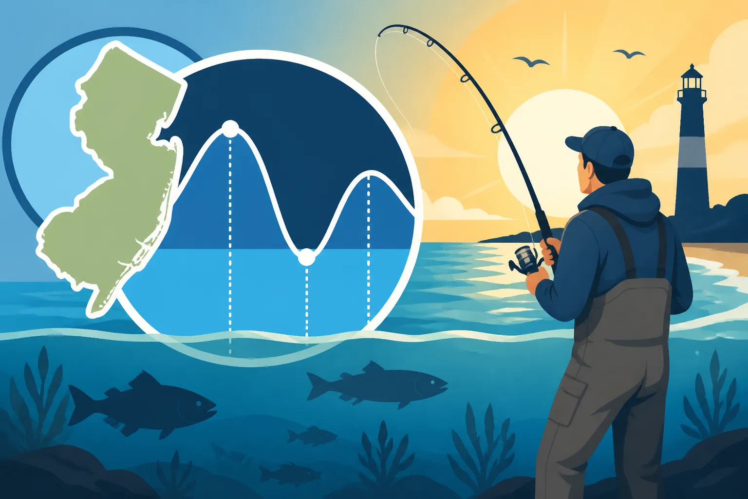
When you look at a tide chart, you'll see predicted times for "high tide" and "low tide." These are the peak and trough points, respectively. However, for fishing, what often matters more is the movement of the water between these points.
- Rising Tide (Flood Tide): This is the period when the water level is increasing, moving from low to high. As the water pushes in, it often brings cooler, cleaner ocean water into bays and estuaries, stirring up baitfish and making them more accessible to predators. Many anglers swear by the incoming tide, especially for species like striped bass and fluke.
- High Tide Slack: This is the brief period, usually around 15-30 minutes, when the water movement slows down and nearly stops at the peak of the high tide. Fishing can be slower during this time, as the currents that dislodge bait are minimal.
- Falling Tide (Ebb Tide): This is when the water level is decreasing, moving from high to low. As water drains out of bays and rivers, it flushes baitfish out of marsh grass and structure, concentrating them in deeper channels or around points. This can be fantastic for many species, especially those that ambush prey. If you're wondering How to Fish a Falling Tide, this is often a highly productive period.
- Low Tide Slack: Similar to high tide slack, this is the brief pause at the bottom of the low tide cycle. Again, fishing can be challenging due to the lack of current, but sometimes fish will concentrate in deeper holes as the water recedes.
Understanding these phases is crucial because fish react differently to each. For example, striped bass might push into shallow flats on a rising tide to hunt, then retreat to deeper channels on a falling tide.
Different Types of Tide Charts
You might be thinking, "Where do I even find these charts?" Luckily, they're everywhere these days, far beyond the old newspaper listings.
- Paper Tide Tables: Many bait and tackle shops still offer free paper tide tables, especially at the start of the season. They're reliable but can be bulky and location-specific. You might find them packaged with a New Jersey Fish and Wildlife Digest, which is always a good read for all the regulations.
- Online Resources: Websites dedicated to marine weather and fishing are a goldmine. Just punch in your New Jersey location, and you’ll get detailed, often interactive, tide charts. Many offer predictions days or even weeks in advance.
- Fishing Apps: There are countless smartphone apps available (many for free, some paid) that combine tide data with moon phases, weather, and even solunar tables. These are super convenient for on-the-go planning and often have predictive maps. Many anglers find these indispensable for a truly mobile planning experience, and you can often find highly-rated ones on Amazon.
- Tide Watches: For the hardcore angler, specialized tide watches can give you real-time tide information right on your wrist, often including moon phase data. These are fantastic for spontaneous trips or when you’re out of cell service range. You can usually find a good selection of these practical accessories on Amazon.
No matter your preference, having a reliable source for tide information is non-negotiable for serious New Jersey anglers.
Deciphering a New Jersey Tide Chart for Anglers
Now that you know what tides are and where to find the info, let’s break down how to actually read a tide chart and turn that data into actionable fishing intel. It’s not just a bunch of numbers; it’s a story about the water’s movement.
Key Information You'll Find on a Tide Chart
A typical tide chart will provide several pieces of vital information for your chosen location:
- Date: Obviously, this tells you which day the predictions are for.
- Time: This is when the high and low tides are predicted to occur. Usually presented in a 24-hour format or with AM/PM indicators.
- Height: This measurement tells you the vertical distance the water rises or falls from a local datum, or average low water. It's usually measured in feet or meters. A higher number for high tide means a bigger influx of water, potentially stronger currents. A lower number for low tide might mean more exposed mud flats or shallower access.
- Direction (sometimes): Some advanced charts or apps might even show you the predicted current direction, which is super useful for drift fishing.
Pay close attention to the difference in height between a high and low tide. A larger difference, known as the tidal range, usually means stronger currents and more aggressive feeding periods.
Identifying Prime Fishing Windows
This is where the magic happens! Knowing the times of high and low tide isn't enough; you need to understand how the transition periods influence fish behavior.
- Moving Water is Key: Generally, fish are most active when the water is moving, either rising or falling. This is because the current stirs up bait, dislodges crabs and worms, and carries scents, making it easier for predators to find a meal.
- For species like fluke, a strong drift on a moving tide is essential for covering ground and presenting your bait naturally. Knowing How to Drift Fish for Fluke often relies heavily on understanding current flow.
- Striped bass are often masters of using current to their advantage, ambushing prey in rips and eddies. If you're targeting them, understanding How to Jig for Striped Bass in varying currents can make all the difference.
- The Hour Before and After: Many veteran anglers will tell you that the hour before and the hour after a tide change (both high and low) are often the most productive. The currents are strengthening or weakening, creating dynamic feeding opportunities.
- Slack Tide Challenges: While moving water is generally preferred, don't write off slack tide entirely. Sometimes, at dead low tide, fish will school up in deeper channels or holes, making them easier to target if you know where these structures are. At high tide slack, some species might move into shallower, calmer waters to relax before the next current cycle.
- Specific Species Preferences: Different fish have different preferences.
- Striped Bass: Often favor moving water, especially around inlets, bridges, and structure where bait is concentrated. The Raritan Bay Striped Bass Season Timing often correlates with strong tidal movements.
- Fluke: Love a good drift. A gently moving tide allows them to ambush bait from the bottom. Barnegat Bay Fluke Fishing in Summer is prime when the tides are moving just right for a slow, natural presentation.
- Bluefish: Aggressive feeders that thrive in strong currents, often creating "blitzes" when baitfish are trapped. If you want to know Best Time of Day to Fish for Bluefish, it's usually when the tides are pushing bait around.
Accounting for Local Anomalies and Delays
Here’s a crucial tip for New Jersey anglers: a tide chart for "Barnegat Inlet" isn't going to be perfectly accurate for the back channels of Barnegat Bay, nor will a chart for "Sandy Hook" be exact for the Navesink River. Tide charts are typically based on primary tidal stations, usually at major inlets or harbors.
- Inlet Influence: Major inlets like Manasquan Inlet or Barnegat Inlet will experience tide changes first, often with stronger currents. The tide then propagates into the bays and rivers, but it takes time.
- Back Bay Delays: As the tide pushes inland, it often experiences a delay. A high tide predicted for Manasquan Inlet at 10 AM might not reach the backwaters of Point Pleasant Canal until 11 AM or even noon. These delays can be significant, sometimes by several hours in far reaches of bays or up rivers.
- Hydrography Matters: The shape and depth of the waterway also affect how the tide moves. Narrow channels, shallow flats, and extensive marshlands can all alter the timing and strength of the currents.
- Correction Factors: Many detailed tide charts or apps will offer "correction factors" or "secondary stations" for specific locations within a bay or river. Always try to find the tide information for the closest possible spot to your actual fishing location.
Ignoring these local anomalies is a common mistake that can lead to missed opportunities. Don't just look at one main station and assume it applies everywhere!
Practical Application: Planning Your Fishing Trip with Tide Charts
Now let’s bring it all together. How do you actually use this information to plan a successful fishing trip in New Jersey? It's about combining tide data with other factors to create a comprehensive strategy.
Combining Tide Data with Species Behavior
Your tide chart becomes a powerful tool when you cross-reference it with the habits of your target species.
- Striped Bass: For the popular striped bass, moving water around structure like jetties, bridge pilings, or rocky outcrops is often key. Check the tide chart for periods of strong current, usually mid-incoming or mid-outgoing. If you're fishing the Jersey Shore, understanding How to Use a Tide Chart When Planning a Fishing Trip for a specific beach can help you predict when the rips will form, concentrating bait and stripers. For the fall run, understanding the general Best Time of Year to Fish for Striped Bass in New Jersey and then narrowing down the best tides with your chart is a winning combination.
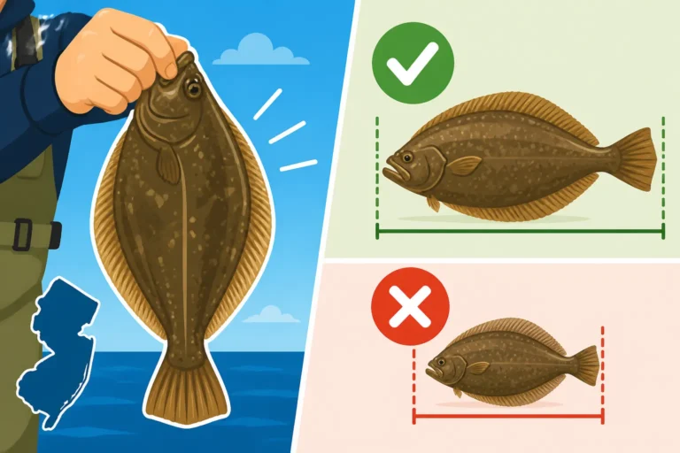
- Fluke (Summer Flounder): Fluke love to ambush bait from the bottom. A steady, moderate current is ideal for drifting baits or bucktails across sandy or muddy bottoms. Look for tides that aren't too slack, but also not so ripping that your tackle can't hold bottom. If you want to understand the New Jersey Fluke Size Limit: 18 Inches you also need to ensure you're fishing during productive tides to even encounter these fish.
- Bluefish: These aggressive predators are often found wherever bait is being pushed around. Strong currents and tidal rips can trigger intense feeding frenzies, known as bluefish blitzes. If you see a rising or falling tide coinciding with dawn or dusk, you might be in for a treat.
- Trout: While freshwater trout in streams like the Pequest River aren't directly impacted by ocean tides, those in tidal rivers like parts of the Delaware River certainly are. Understanding how the ebb and flow affects water levels and current in these transition zones is crucial.
Consider the tide chart as a foundational layer for your fishing strategy, then add specific species knowledge on top.
Safety First: Tides and Navigation
Beyond just catching fish, understanding tides is absolutely vital for safety, especially if you're boating, kayaking, or even wading.
- Strong Currents: During periods of strong tidal flow, currents can be incredibly powerful, especially around inlets, bridges, and narrow channels. These can make boat handling difficult, kayaking dangerous, and wading perilous. Always check the tide chart and current predictions before heading out, particularly in areas known for swift water.
- Shallow Water and Obstacles: Low tide can reveal submerged rocks, sandbars, and other hazards that are invisible at high tide. If you're navigating a boat or kayak in unfamiliar waters, be extra cautious during outgoing tides, as water levels will drop, potentially stranding you or causing damage. Knowing the predicted low tide height can help you avoid these situations.
- Wading Safely: For surf anglers or those wading in bays, understanding the incoming and outgoing tides is critical. A rapidly rising tide can cut off access to sandbars or make crossing channels dangerous. Conversely, a strong outgoing tide can create powerful undertows in inlets. Always be aware of your escape route and the direction of the current. Being familiar with How to Read a Rip Current for Safer Surf Fishing is another essential safety skill.
You can find excellent resources, including charts and safety guides, that clearly illustrate tidal currents and potential hazards. These are readily available from marine supply stores or through online retailers like Amazon.
Integrating Weather and Moon Phases
Tide charts are powerful, but they are just one piece of the puzzle. For truly optimal planning, you need to layer in other environmental factors.
- Moon Phases: The moon's gravitational pull isn't constant. During new and full moons, the sun, moon, and Earth align, creating stronger gravitational forces. This results in "spring tides" (no, not related to the season, but to the "springing forth" of the tide), which have higher high tides and lower low tides, meaning stronger currents. Conversely, during quarter moons, the sun and moon are at right angles, leading to weaker "neap tides" with less dramatic tidal ranges. Many anglers find spring tides to be more productive due to the increased water movement.
- Wind Direction and Strength: Wind can significantly influence actual water levels and current strength, sometimes overriding tidal predictions. A strong onshore wind (blowing towards the coast) can "pile up" water, making a high tide even higher and delaying the outgoing tide. An offshore wind can have the opposite effect. For surf fishing, understanding how wind interacts with tides is crucial for casting and presenting bait. If you're figuring out Best Tide for Surf Fishing Striped Bass, don't forget to factor in the wind.
- Barometric Pressure: While less direct, changing barometric pressure can also affect fish activity. A stable or slowly falling barometer often correlates with good fishing, while rapidly changing pressure can put fish off the bite. This is a subtle factor but worth considering alongside your tide plan. You can read more about How Barometric Pressure Affects Fishing to fine-tune your approach.
By considering all these elements – tide, moon phase, and weather – you can make the most informed decision about when and where to wet a line in New Jersey.
Common Mistakes and Advanced Tips for Tide Chart Use
Even with a basic understanding, there are nuances and common pitfalls to avoid when using tide charts for fishing in New Jersey. Let's make sure you're getting the most out of your planning.
Don't Just Look at High or Low
One of the biggest mistakes anglers make is simply noting the times of high and low tide and ignoring the hours in between. As we've discussed, the moving water is often where the action is.
- Focus on the Transition: The periods of strong current, typically an hour or two after the tide starts to move and an hour or two before it reaches its peak or trough, are often the most productive. These are the windows where bait is flushed out, and predators are actively feeding.
- The "Fish Window": Instead of just planning for "high tide fishing," look for your "fish window"—that 2 to 3-hour period of optimal current flow. If you plan to fish for a full 4-5 hours, you should anticipate varying conditions throughout that time.
- Example: If high tide is at 10 AM, and low tide is at 4 PM, the prime outgoing current might be strongest between 1 PM and 3 PM. Don't just show up at 10 AM and expect a hot bite if your target species prefers a strong ebb. For many, figuring out Best Tide to Fish a New Jersey Inlet often means focusing on the middle of the outgoing tide.
Using Tide Charts for Specific Locations
As mentioned earlier, generic tide charts are a starting point, but New Jersey's diverse waterways demand more specific attention.
- Inlets: Inlets are bottlenecks where massive amounts of water rush in and out. Here, the currents are often strongest, making for fantastic fishing but also requiring heavier tackle and careful boat handling. The peak of the incoming or outgoing tide is often prime for stripers and bluefish in these areas. You can also find great opportunities for black sea bass or tautog around the rocks and structure here.
- Open Bays: In large, open bays like Barnegat Bay or Great Egg Harbor Bay, currents might be less intense than in inlets, but they are still crucial for drift fishing for fluke or targeting schooled fish. Look for areas where channels constrict or where points extend, as these will funnel baitfish.
- Tidal Rivers and Estuaries: Up tidal rivers like the Mullica or Raritan, the tide changes can be significantly delayed and the current less pronounced. However, the rising tide can push brackish water into freshwater zones, triggering feeding, and the falling tide can concentrate fish in deeper channels. Understanding How to Fish New Jersey's Tidal Rivers requires a keen eye on these unique tidal dynamics.
- Surf Fishing: For surf casters, tides dictate where the baitfish are held, how rip currents form, and how far you can cast into productive water. A rising tide often pushes bait closer to shore, while a falling tide can create troughs and rips that hold fish. Learning How to Cast Farther When Surf Fishing might be less important than casting into the right water at the right tide.
Tidal Current vs. Tidal Height Table
| Tidal Characteristic | Description | Impact on Fishing | Example Species |
|---|---|---|---|
| Rising Tide | Water level increases; current typically flows inland. | Flushes bait into bays; fish move into shallower areas to feed. | Striped Bass, Fluke (early flood), Weakfish |
| High Tide Slack | Brief period of minimal current at peak high water. | Can be slow; fish might hold tight to structure or move to calmer spots. | Tautog (often bite well in slack), Crabs |
| Falling Tide | Water level decreases; current typically flows towards the ocean. | Flushes bait out of marshes/structure; concentrates fish in channels/inlets. | Striped Bass, Bluefish, Fluke (late ebb) |
| Low Tide Slack | Brief period of minimal current at lowest water level. | Can be slow; fish concentrate in deep holes; exposes structure. | Catfish, small panfish (in deep pockets) |
| Strong Current | Large tidal range; fast water movement. | Dislodges lots of bait; aggressive feeding; requires heavier tackle. | Striped Bass, Bluefish, Drum |
| Weak Current | Small tidal range; slow water movement. | More subtle bait movement; good for delicate presentations or still fishing. | Fluke (slow drift), Bottom Fish |
By understanding these relationships, you're not just reading a chart; you're predicting fish behavior. Always be ready to adapt, and remember that local knowledge, gained from experience or talking to local anglers, is invaluable. Tight lines!
Disclaimer
This article is for general informational purposes only and does not constitute professional advice. Laws, prices and regulations vary by location and change over time. Consult a qualified professional for guidance on your specific situation.